
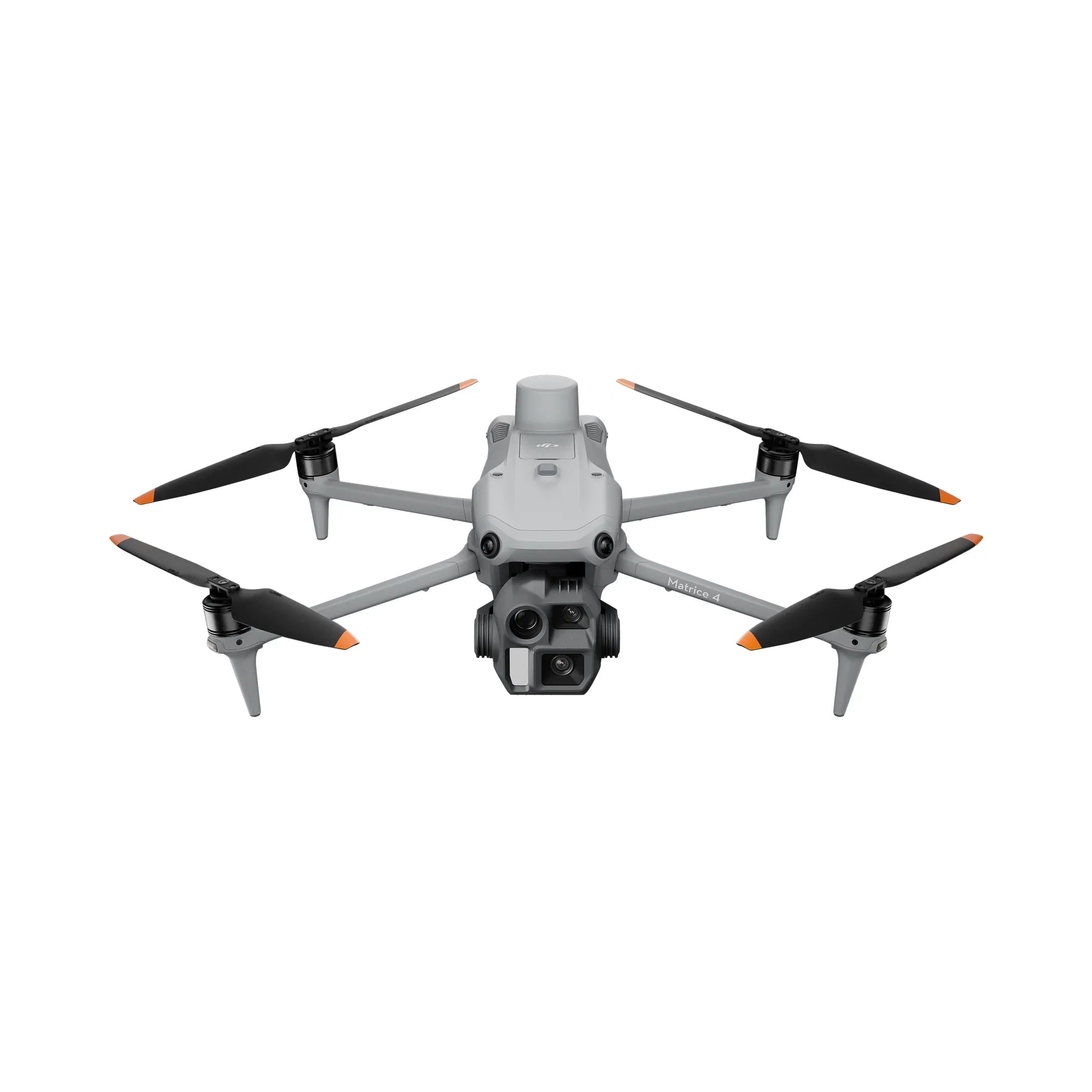
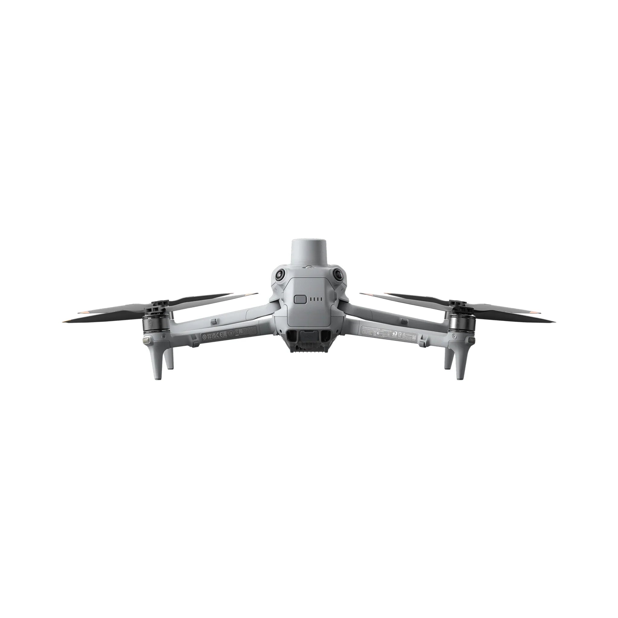
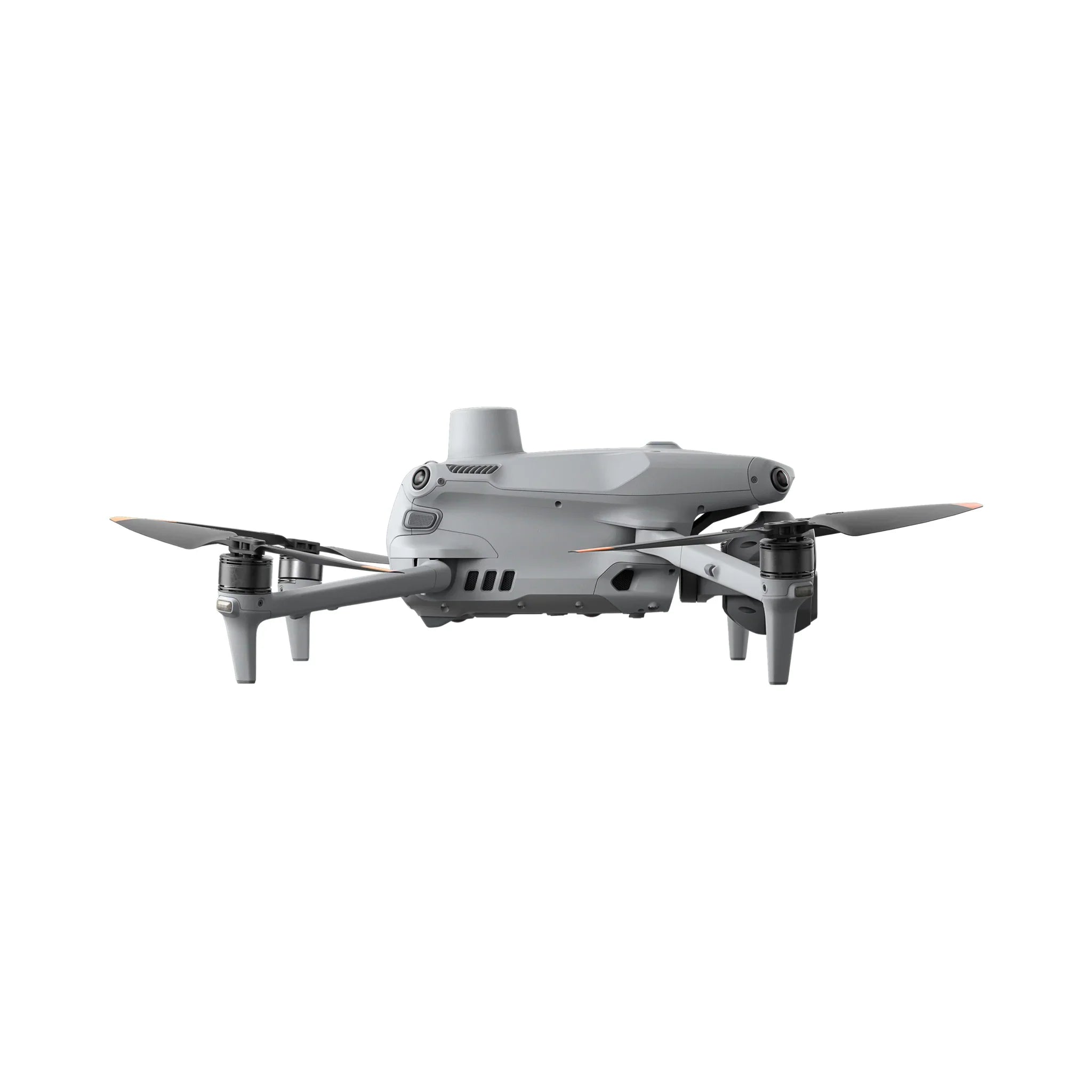
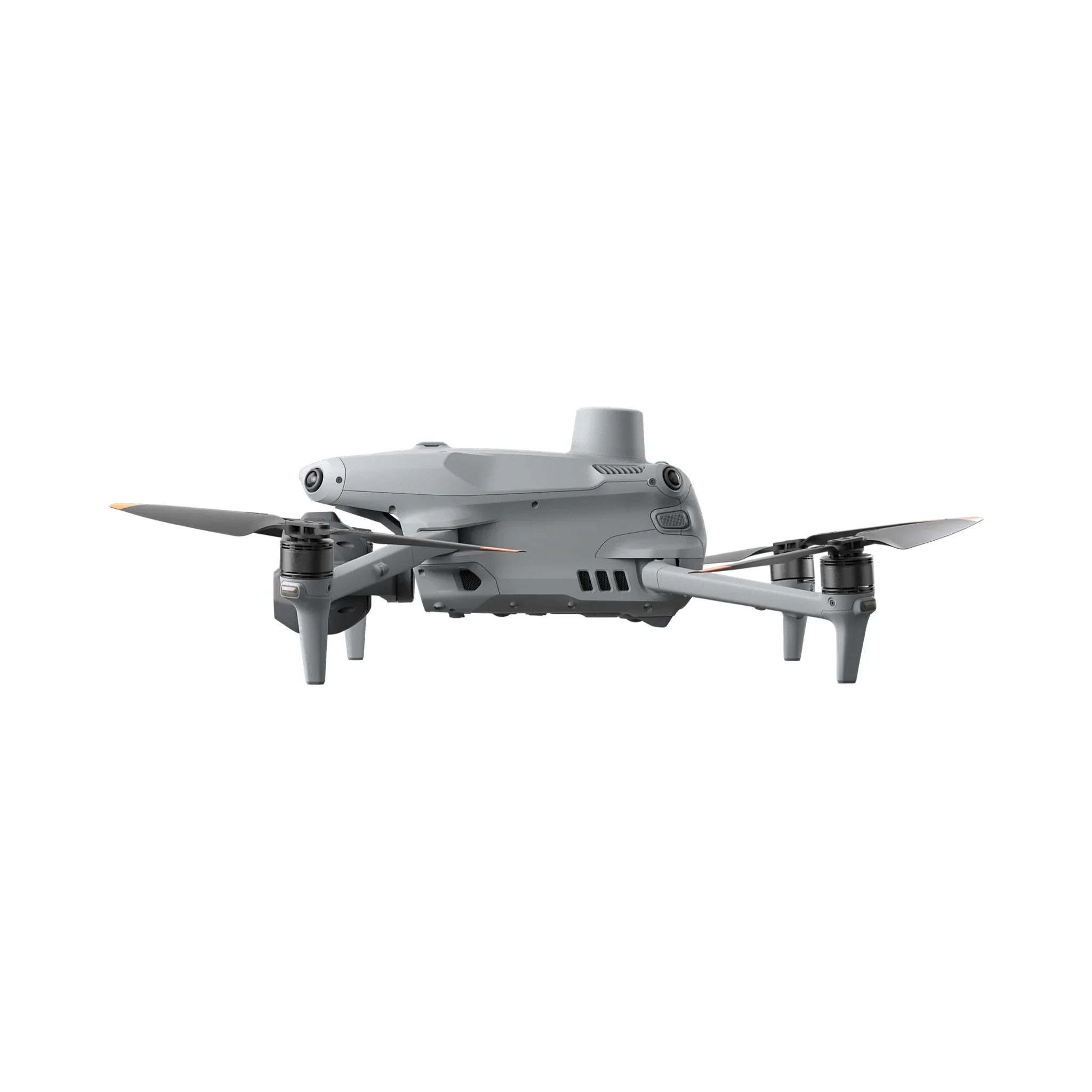
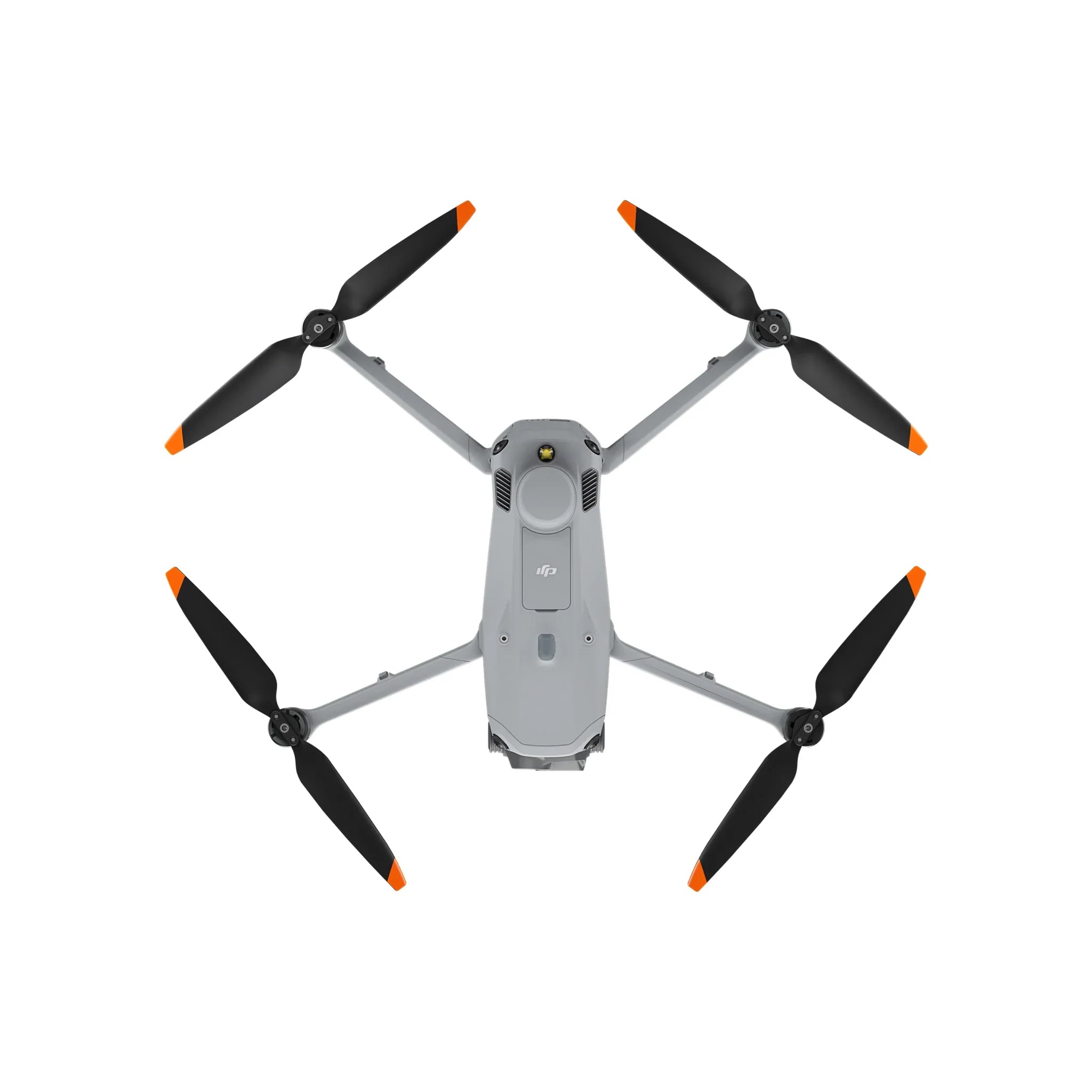
DJI Matrice 4E (M4E) Enterprise Mapping & Surveying Drone
The DJI Matrice 4E (M4E) is a compact, intelligent enterprise mapping and surveying drone engineered for high-precision geospatial work, construction, engineering, mining, infrastructure inspection, and professional photogrammetry. Designed specifically for efficient aerial mapping, the DJI M4E combines a high-resolution wide-angle camera, mechanical shutter, rapid interval shooting, RTK positioning, laser rangefinder, and intelligent mapping capabilities in a highly portable enterprise platform.
For Canadian organizations looking for a professional DJI mapping drone, the Matrice 4E delivers an excellent combination of accuracy, portability, automation, and operational efficiency. Its mapping-focused camera features a 4/3 CMOS 20 MP sensor with a mechanical shutter, supporting rapid 0.5-second interval shooting to efficiently capture large areas while maintaining the image consistency required for photogrammetry.
The DJI Matrice 4E also features integrated RTK positioning, allowing professional operators to achieve highly accurate positioning when used with compatible DJI RTK solutions. Combined with DJI Terra and DJI FlightHub 2, the M4E provides a complete workflow from mission planning and aerial data collection through mapping, modelling, measurement, and analysis.
Whether you're conducting land surveys, construction progress monitoring, stockpile measurements, mining operations, infrastructure inspections, or creating detailed 2D and 3D models, the DJI Matrice 4E (M4E) provides enterprise-grade capabilities in a compact aircraft that's fast to deploy in the field.
Built for Professional Mapping & Surveying
Unlike general-purpose camera drones, the DJI M4E is specifically optimized for mapping and photogrammetry.
The Matrice 4E wide-angle camera features a 4/3 CMOS sensor, 20 MP resolution, and mechanical shutter, allowing the aircraft to efficiently capture consistent imagery required for professional mapping missions.
With a minimum shooting interval of 0.5 seconds, operators can collect imagery quickly while covering large project areas efficiently.
This makes the DJI Matrice 4E particularly well suited for:
-
Land Surveying
-
RTK Mapping
-
Photogrammetry
-
Construction Mapping
-
Stockpile Measurement
-
Volumetric Analysis
-
Mining
-
Quarry Operations
-
Engineering
-
GIS & Geospatial Data Collection
-
Infrastructure Inspection
-
Construction Progress Monitoring
Multi-Camera Enterprise Imaging System
The DJI Matrice 4E isn't limited to its mapping camera. Its multi-camera system gives operators greater flexibility when documenting and inspecting assets from different distances.
Wide-Angle Camera
-
4/3 CMOS Sensor
-
20 MP
-
Mechanical Shutter
-
24 mm Equivalent Focal Length
-
f/2.8–f/11 Adjustable Aperture
-
Minimum Shooting Interval: 0.5 seconds
The wide-angle camera is the primary mapping camera and is optimized for efficient aerial surveying and photogrammetry.
Medium Tele Camera
-
1/1.3-inch CMOS Sensor
-
48 MP
-
70 mm Equivalent Focal Length
-
3× Optical Zoom
The medium tele camera provides additional detail when inspecting structures, buildings, utilities, and other assets.
Tele Camera
-
1/1.5-inch CMOS Sensor
-
48 MP
-
168 mm Equivalent Focal Length
-
7× Optical Zoom
The telephoto camera allows operators to inspect distant objects while maintaining a safer operating distance.
Integrated Laser Rangefinder
The DJI M4E features an integrated laser rangefinder capable of measuring distances to objects and identifying target locations.
This provides valuable capabilities for:
-
Distance Measurement
-
Coordinate Identification
-
Asset Inspection
-
Emergency Response
-
Construction
-
Survey Planning
-
Infrastructure Management
RTK Precision Positioning
Integrated RTK capability makes the DJI Matrice 4E particularly valuable for professional mapping and surveying applications.
When used with compatible DJI RTK infrastructure or network correction services, the aircraft can obtain highly accurate positioning information during data collection.
This improves the efficiency and consistency of mapping workflows while reducing reliance on traditional ground-control methods for suitable projects.
Smart 3D Capture
The Matrice 4E supports intelligent Smart 3D Capture workflows, allowing operators to create rough models directly during operations and generate precise mapping routes around buildings and structures.
This makes complex structure modelling and close-range data collection significantly more efficient.
Enhanced Low-Light Performance
The Matrice 4E is designed to maintain strong imaging performance in challenging lighting conditions.
Improved low-light capabilities help operators continue collecting useful visual information during early morning, late afternoon, overcast, and other lower-light environments.
Intelligent Flight & Safety Systems
DJI has equipped the M4E with advanced sensing and positioning technologies designed for professional operations.
Key capabilities include:
-
Omnidirectional obstacle sensing
-
RTK positioning
-
GNSS positioning
-
Intelligent Return-to-Home
-
Vision-assisted navigation
-
Automated mapping missions
-
Terrain-following capabilities
-
Intelligent flight planning
-
Advanced mission automation
These systems help operators safely and efficiently complete complex enterprise missions.
DJI O4 Enterprise Transmission
The DJI Matrice 4E utilizes DJI's O4 Enterprise video transmission system, providing a stable, high-quality communication link between the aircraft and remote controller.
The system is designed for demanding professional environments where dependable video transmission and aircraft control are essential.
Compact Enterprise Platform
One of the biggest advantages of the DJI M4E is portability.
Unlike larger enterprise aircraft, the Matrice 4E uses a compact folding design that can be rapidly transported and deployed by a single operator.
This makes it particularly valuable for survey crews, construction teams, engineers, inspectors, and organizations that regularly move between multiple project sites.
Key Features
-
DJI Matrice 4E Enterprise Drone
-
Also commonly known as the DJI M4E
-
Professional mapping and surveying platform
-
4/3 CMOS 20 MP wide-angle camera
-
Mechanical shutter
-
0.5-second interval shooting
-
Adjustable f/2.8–f/11 aperture
-
Integrated RTK positioning
-
Medium tele camera
-
Telephoto camera
-
3× optical zoom
-
7× optical zoom
-
Integrated laser rangefinder
-
Smart 3D Capture
-
Automated mapping missions
-
Omnidirectional obstacle sensing
-
DJI O4 Enterprise transmission
-
Compact folding design
-
DJI Pilot 2 support
-
DJI Terra compatibility
-
DJI FlightHub 2 compatibility
-
Designed for professional enterprise operations
Ideal Applications
Surveying & Mapping
Create accurate aerial datasets for land surveying, engineering, GIS, and geospatial applications.
Construction
Monitor construction progress, document job sites, create orthomosaics, and generate accurate project models.
Mining & Quarry Operations
Perform stockpile measurements, volumetric calculations, site mapping, and operational monitoring.
Infrastructure Inspection
Inspect buildings, bridges, utilities, towers, roofs, and other critical infrastructure.
Photogrammetry
Capture high-quality overlapping imagery for detailed 2D maps and 3D reconstruction.
Engineering
Provide engineers and project managers with current aerial data for planning, documentation, and analysis.
DJI Terra Integration
Pair the DJI Matrice 4E with DJI Terra to transform aerial imagery into professional geospatial deliverables.
Depending on your workflow and software configuration, DJI Terra can be used to generate:
-
2D Orthomosaic Maps
-
3D Models
-
Point Clouds
-
Digital Surface Models
-
Measurements
-
Volumetric Calculations
-
Mapping Deliverables
This provides an integrated DJI workflow from aerial data collection through processing and analysis.
DJI FlightHub 2 Integration
DJI FlightHub 2 provides cloud-based fleet and mission management capabilities for organizations operating DJI Enterprise aircraft.
Organizations can use compatible FlightHub 2 functionality for mission planning, operational coordination, data management, and collaboration between field operators and remote teams.
Why Choose the DJI Matrice 4E?
The DJI Matrice 4E (M4E) brings professional mapping technology into a compact enterprise platform.
For surveyors, engineers, construction companies, mining operations, and geospatial professionals, its combination of mechanical shutter, RTK positioning, rapid interval photography, multi-camera imaging, laser ranging, and intelligent mapping capabilities provides a highly efficient solution for collecting aerial data.
Its compact size also makes the M4E considerably easier to transport and deploy than larger enterprise platforms, making it an excellent everyday mapping aircraft for professional field crews.
Frequently Asked Questions
What is the DJI M4E?
DJI M4E is a commonly used abbreviation for the DJI Matrice 4E, DJI's compact enterprise drone designed primarily for professional mapping, surveying, photogrammetry, construction, and geospatial applications.
Is the DJI Matrice 4E designed for mapping?
Yes. Mapping is one of the primary applications of the Matrice 4E. Its 4/3 CMOS 20 MP camera features a mechanical shutter and rapid 0.5-second interval shooting specifically suited to efficient photogrammetry and aerial mapping.
Does the DJI M4E have RTK?
Yes. The DJI Matrice 4E includes integrated RTK positioning capabilities for high-precision enterprise operations.
Does the DJI Matrice 4E have a mechanical shutter?
Yes. The Matrice 4E's 20 MP 4/3 CMOS wide-angle camera features a mechanical shutter, making it particularly well suited to aerial mapping and photogrammetry.
What is the difference between the DJI Matrice 4E and Matrice 4T?
The Matrice 4E is primarily optimized for mapping, surveying, and photogrammetry, with its 4/3 CMOS mapping camera and mechanical shutter.
The Matrice 4T is primarily optimized for inspection, public safety, search and rescue, and thermal applications, adding a thermal imaging camera and other capabilities intended for inspection and emergency-response missions.
For professional aerial mapping, the Matrice 4E is generally the preferred Matrice 4 Series model.
Can the DJI M4E be used for construction?
Yes. The M4E is particularly well suited to construction site mapping, progress monitoring, stockpile measurement, site documentation, and creating 2D and 3D project models.
Can the DJI Matrice 4E be used for surveying in Canada?
The Matrice 4E provides the imaging, RTK positioning, and mapping capabilities required for many professional surveying and geospatial workflows. Canadian operators remain responsible for complying with applicable Transport Canada RPAS regulations and any professional surveying requirements applicable to their work.
Does the DJI Matrice 4E work with DJI Terra?
Yes. The Matrice 4E integrates with DJI Terra for professional mapping, photogrammetry, modelling, and data-processing workflows.
Who should buy the DJI Matrice 4E?
The M4E is an excellent choice for:
-
Professional Surveyors
-
Mapping Companies
-
Construction Companies
-
Civil Engineers
-
Mining Companies
-
Quarry Operators
-
GIS Professionals
-
Geospatial Professionals
-
Infrastructure Inspectors
-
Government Organizations
-
Environmental Consultants
-
Enterprise Drone Operators
Why Buy the DJI Matrice 4E in Canada from Drone Labs?
Drone Labs is a Canadian DJI Enterprise solutions provider offering professional drone equipment, technical expertise, and support for commercial and enterprise customers.
When purchasing your DJI Matrice 4E (M4E) from Drone Labs, our team can help you select the appropriate aircraft, batteries, RTK equipment, software, accessories, and mapping solutions for your specific application.
Whether you're deploying the M4E for surveying, construction, mining, photogrammetry, mapping, or infrastructure inspection, Drone Labs can help you build a complete DJI Enterprise solution for your operation.
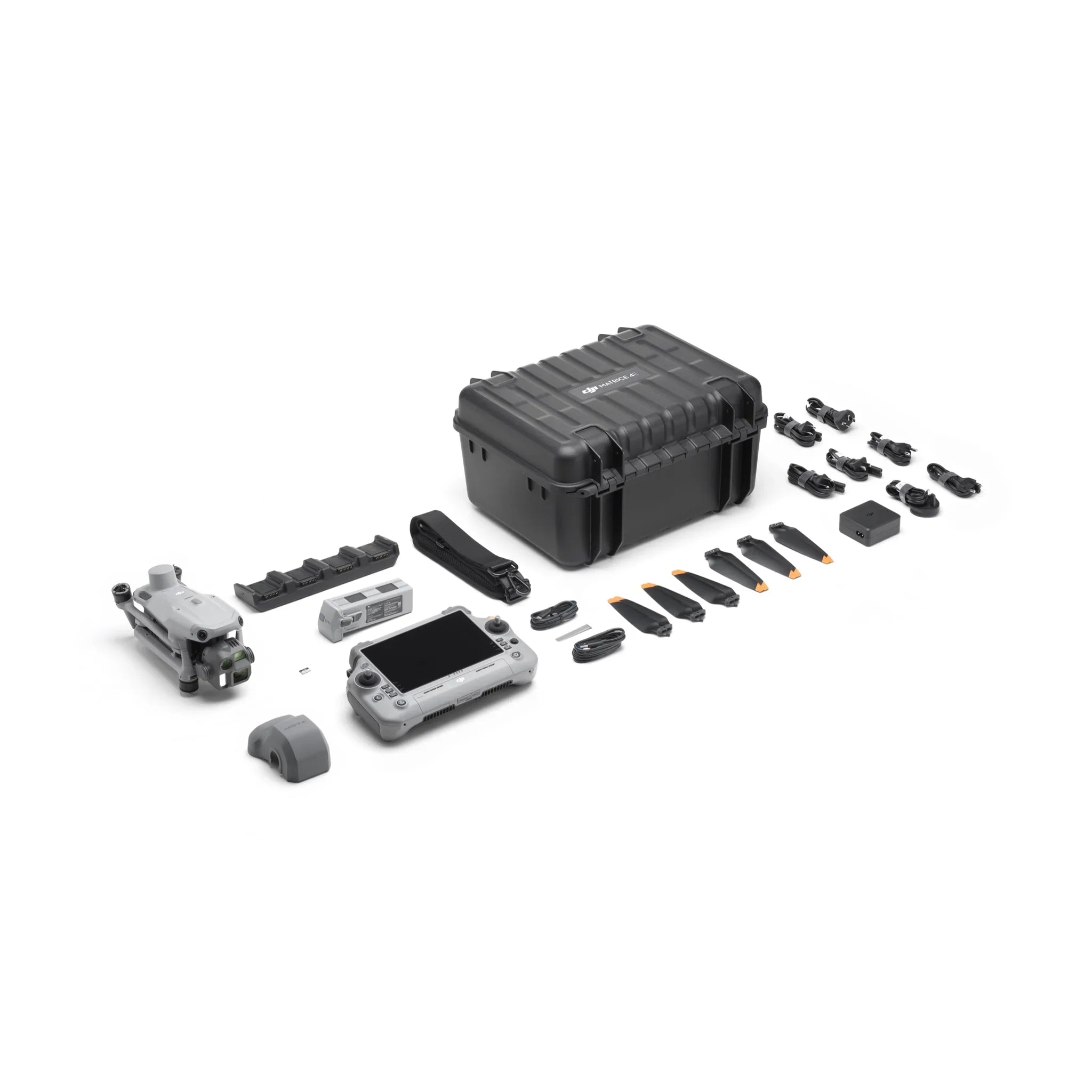
Package Includes:
1x DJI Matrice 4E
1x DJI Matrice 4 Series Battery
1x DJI RC Plus 2 Enterprise
1x DJI 100W USB-C Power Adapter
1x DJI Matrice 4 Series Charging Hub
1x microSD Card
1x DJI Matrice 4E Gimbal Protector
1x DJI Cellular Dongle 2 Pry Bar
3x DJI Matrice 4 Series Propellers
1x 100W Power Adaptor AC Cable
1x USB-C to USB-C Data Cable
1x USB-A to USB-C Data Cable
1x DJI Matrice 4 Series Storage Case
1x DJI Matrice 4 Series Storage Case Shoulder Strap