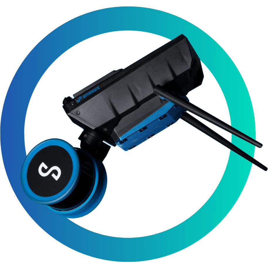
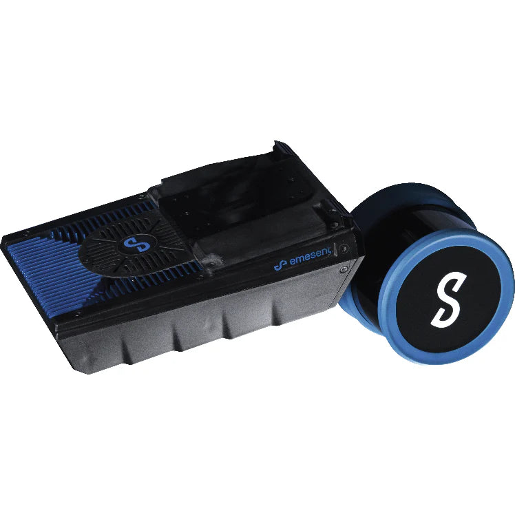
Hovermap ST-X – Long-Range LiDAR Scanner for High-Density 3D Mapping
The Hovermap ST-X is a groundbreaking LiDAR scanner and mobile mapping solution engineered for long-range, high-density 3D data capture. Delivering a sensing range of up to 300 meters and capturing over one million points per second, the ST-X provides unparalleled coverage and detail—reducing scan time while increasing accuracy.
Powered by Emesent’s award-winning Wildcat SLAM technology and enhanced by Automated Ground Control Points, the ST-X achieves sub-centimeter precision, whether you’re scanning vast outdoor landscapes or performing close-range indoor mapping.
Key Features & Benefits
-
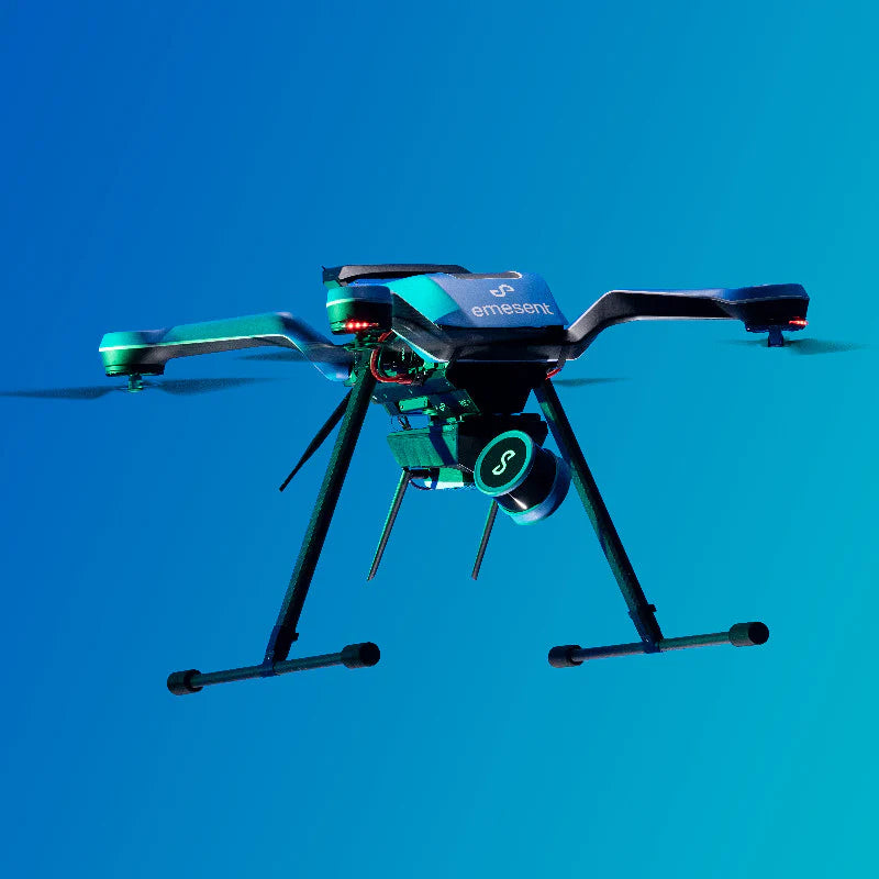
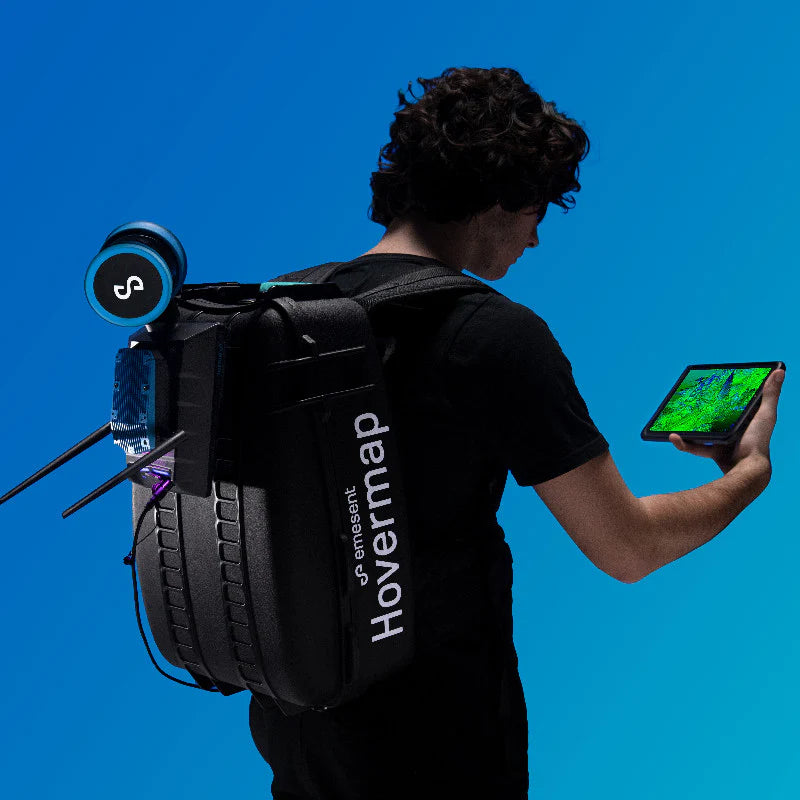
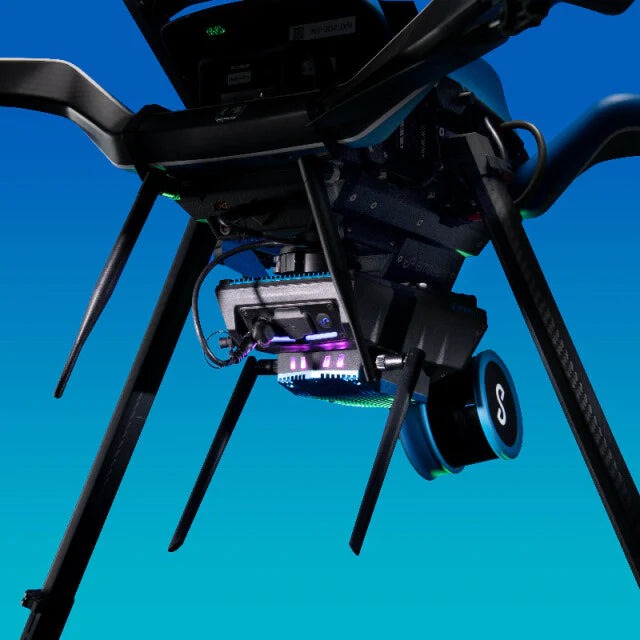
Unmatched Versatility: Deployable as a drone LiDAR system, handheld unit, vehicle-mounted scanner, or backpack mapping solution—ideal for both GPS-denied environments and open landscapes.
-
Rugged Design: Weather-sealed (IP65), dust- and splash-resistant, built for tough field conditions.
-
Real-Time Point Cloud Streaming: Preview LiDAR data instantly on a tablet for faster insights and quality assurance.
-
Enhanced Vegetation Penetration: Triple returns and a rotating LiDAR sensor generate dense, reliable point clouds—perfect for forestry and environmental mapping.
-
Survey-Grade Accuracy: Capture detailed scans of linear assets, large-scale sites, and complex infrastructure with industry-leading precision.
-
Autonomous Intelligence: Choose from Mapping Mode for efficient mobile scanning or Autonomous Waypoint Mode for safe, beyond visual line of sight (BVLOS) drone flights.
A Complete LiDAR Mapping Solution
The Hovermap ST-X is more than just a LiDAR sensor—it’s a comprehensive 3D mapping solution trusted across industries such as surveying, construction, mining, forestry, and infrastructure inspection. With its long-range capabilities, sub-centimeter accuracy, and adaptive deployment options, the ST-X empowers professionals to capture critical data faster, safer, and with unrivaled detail.