Overview
PLANT INTELLIGENCE FOR TARGETED ACTION
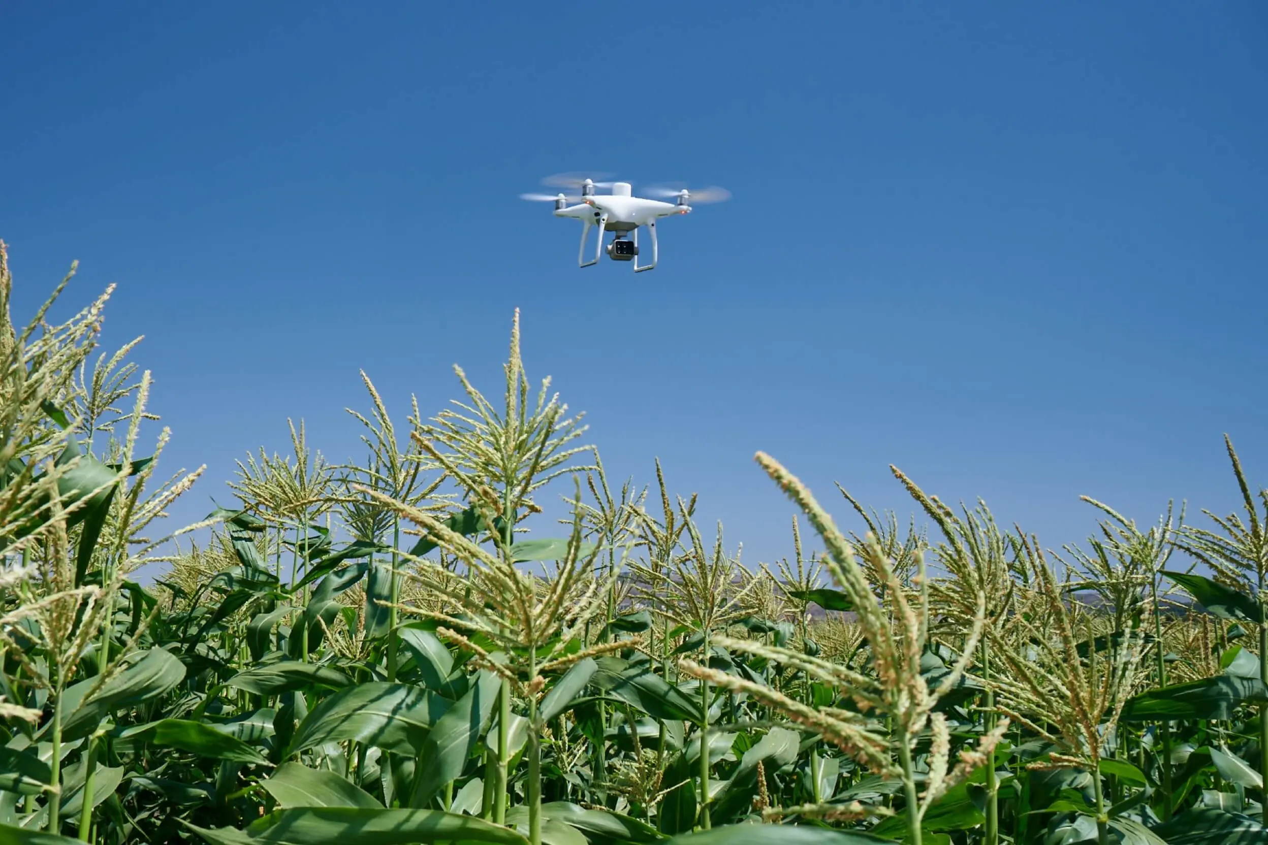
Gather precise plant-level data using the P4 Multispectral – a high-precision drone with a seamlessly integrated multispectral imaging system built for agriculture missions, environmental monitoring, and more.
FARM TO FIGURES
GAIN IMMEDIATE INSIGHTS INTO PLANT HEALTH
The P4 Multispectral consolidates the process of capturing data that gives insight into crop health and vegetation management. DJI has created this platform with the same powerful performance standards that DJI is known for, including 27 minutes max flight time and up to 7 km1 transmission range with the OcuSync system.

SEE BENEATH THE SURFACE
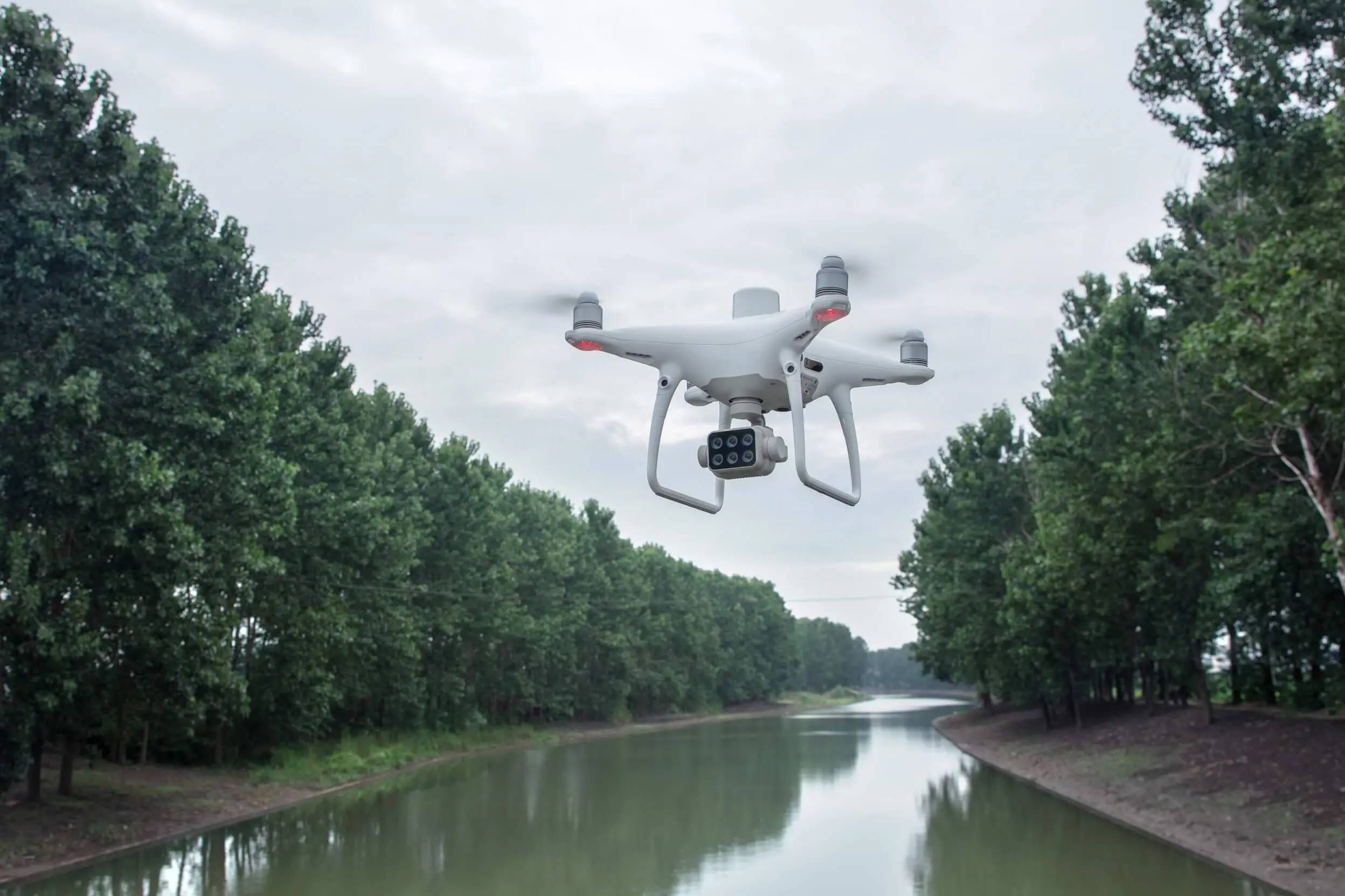
Agriculture imagery collection is now simpler and more efficient than ever before with a built-in stabilized imaging system that collects comprehensive data sets right out of the box. Access information collected by 1 RGB camera and a multispectral camera array with 5 cameras covering Blue, Green, Red, Red Edge, and Near Infrared bands – all at 2 MP with global shutter, on a 3-axis stabilized gimbal.
INTEGRATED SPECTRAL SUNLIGHT SENSOR FOR ACCURATE RESULTS
An integrated spectral sunlight sensor on top of the drone captures solar irradiance, which maximizes accuracy and consistency of data collection through different times of day. When combined with post-processed data, this information helps to obtain the most accurate NDVI results.
MEANINGFUL DATA AT YOUR DISPOSAL
VIEW BOTH RGB AND NDVI FEEDS
Simply having aerial imagery is not enough for ag professionals who want to know more. Switch between a preliminary Normalized Difference Vegetation Index (NDVI) analysis and the live RGB feed to immediately visualize where attention is needed, so targeted treatment decisions can be made quickly.
CENTIMETER-LEVEL PRECISION
Get real-time, accurate positioning data on images captured by all six cameras with DJI’s TimeSync system, providing centimeter-level accurate measurements. The TimeSync system continually aligns the flight controller, RGB and NB cameras, and RTK module, fixing the positioning data to the center of the CMOS and ensuring each photo uses the most accurate metadata. All cameras go through a rigorous calibration process where radial and tangential lens distortions are measured. The distortion parameters gathered are saved into each image’s metadata, letting post-processing software adjust uniquely for every user.

D-RTK 2 MOBILE STATION AND NTRIP COMPATIBILITY
Enhance the accuracy of RTK positioning without internet connection by connecting the P4 Multispectral to the D-RTK 2 High Precision GNSS Mobile Station and NTRIP (Network Transport of RTCM via Internet Protocol)2, or store the satellite observation data to be used for Post Processed Kinematics (PPK).
THE BEGINNING OF INTELLIGENT AGRICULTURE MISSIONS
PLAN FLIGHTS

Plan flights, execute automated missions, and manage flight data using GS PRO – DJI’s leading flight planning iOS app.
CAPTURE DATA

Collect multispectral images efficiently across a large area using the P4 Multispectral and gain an overview of problem areas.
ANALYZE DATA

Easily access and process aerial data by applying plant-specific metrics and parameters to acquire the desired results on plant health.
ACT ON DATA

Implement targeted treatments on areas that need attention based on accurate drone data.
APPLICATIONS
PRECISION AGRICULTURE
Multispectral imagery can be helpful to agriculture professionals throughout all growing seasons by collecting information invisible to the naked eye across the electromagnetic spectrum. With access to this data, farmers can make intelligent, informed decisions on crop treatment to lower costs, maximize yields and save on resources.
ENVIRONMENTAL MONITORING & INSPECTION
Routine maintenance and inspections with plants can be conducted more efficiently with the P4 Multispectral. Users can leverage actionable multispectral insights to map shorelines, measure biomass, monitor forest health or manage riparian vegetation while protecting ecosystems and habitats.
Tech Specs
Aircraft
| Takeoff Weight |
1391 g |
| Diagonal Distance |
350 mm |
| Max Service Ceiling Above Sea Level |
19685 ft (6000 m) |
| Max Ascent Speed |
6 m/s (automatic flight); 5 m/s (manual control) |
| Max Descent Speed |
3 m/s |
| Max Speed |
31 mph (50 kph)(P-mode)
36 mph (58 kph)(A-mode) |
| Max Flight Time |
Approx. 30 minutes |
| Operating Temperature Range |
32° to 104° F (0° to 40℃) |
| Operating Frequency |
2.400 GHz to 2.483 GHz (Europe, Japan, Korea)
5.725 GHz to 5.850 GHz (United States, China) |
| Transmission Power (EIRP) |
2.4 GHz
CE (Europe) / MIC (Japan) / KCC (Korea) :< 20 dBm
5.8 GHz
SRRC(China) / FCC(United States)/NCC(Taiwan,China):< 26 dBm |
| Hover Accuracy Range |
RTK enabled and functioning properly:
Vertical:±0.1 m;Horizontal:±0.1 m
RTK disabled
Vertical:±0.1 m(with vision positioning );
±0.5 m(with GNSS positioning)
Horizontal:±0.3 m(with vision positioning);
±1.5 m(with GNSS positioning) |
| Image Position Offset |
The position of the camera center is relative to the phase center of the onboard D-RTK antenna under the aircraft body's axis:(36, 0, and 192 mm) already applied to the image coordinates in Exif data. The positive x, y, and z axes of the aircraft body point to the forward, rightward, and downward of the aircraft, respectively. |
Mapping Functions
| Mapping Accuracy ** |
Mapping accuracy meets the requirements of the ASPRS Accuracy Standards for Digital Orthophotos Class Ⅲ
** The actual accuracy depends on surrounding lighting and patterns, aircraft altitude, mapping software used, and other factors when shooting. |
| Ground Sample Distance(GSD) |
(H/36.5) cm/pixel,
H means the aircraft altitude relative to shooting scene (unit: m) |
| Data Acquisition Efficiency |
Max operating area of approx. 1 km² for a single flight(at an altitude of 182 m, i.e., GSD is approx. 5 cm/pixel, meeting the requirements of the ASPRS Accuracy Standards for Digital Orthophotos Class Ⅲ |
Vision System
| Velocity Range |
≤31 mph(50 kph) at 6.6 ft(2 m) above ground with adequate lighting |
| Altitude Range |
0-33 ft(0 - 10 m) |
| Operating Range |
0-33 ft(0 - 10 m) |
| Obstacle Sensing Range |
2-98 ft(0.7-30 m) |
| FOV |
Forward/Rear: 60° (horizontal), ±27° (vertical)
Downward: 70° (front and rear), 50° (left and right) |
| Measuring Frequency |
Forward/Rear:10 Hz;
Downward: 20 Hz |
| Operating Environment |
Surfaces with clear patterns and adequate lighting(> 15 lux) |
Camera
| Sensor |
1" CMOS; Effective pixels: 20 M |
| Lens |
FOV 84°;8.8 mm / 24 mm(35 mm format equivalent:24 mm);
f/2.8 - f/11, auto focus at 1 m - ∞ |
| ISO Range |
Video:100-3200(Auto)
100-6400(Manual);
Photo:100-3200(Auto)
100-12800(Manual) |
| Mechanical Shutter Speed |
8 - 1/2000 s |
| Electronic Shutter Speed |
8 - 1/8000 s |
| Max Image Size |
4864×3648(4:3);
5472×3648(3:2) |
| Video Recording Modes |
H.264,4K:3840×2160 30p |
| Photo Format |
JPEG |
| Video Format |
MOV |
| Supported File Systems |
FAT32(≤ 32 GB);
exFAT(> 32 GB) |
| Supported SD Cards |
MicroSD, Max Capacity: 128 GB. Class 10 or UHS-1 rating required Write speed≥15 MB/s |
| Operating Temperature Range |
32° to 104° F (0° to 40℃) |
Intelligent Flight Battery(PH4-5870mAh-15.2V)
| Capacity |
5870 mAh |
| Voltage |
15.2 V |
| Battery Type |
LiPo 4S |
| Energy |
89.2 Wh |
| Net Weight |
468 g |
| Charging Temperature Range |
14° to 104℉(-10° to 40℃) |
| Max charging Power |
160 W |
Intelligent Battery Charing Hub(WCH2)
| Input Voltage |
17.3 - 26.2 V |
| Output Voltage and Current |
8.7 V,6 A;5 V,2 A |
| Operating Temperature |
41° to 104℉(5° to 40℃) |
SDK Remote Controller
| Operating Frequency |
2.400 GHz to 2.483 GHz (Europe, Japan, Korea)
5.725 GHz to 5.850 GHz (Other countries/regions) |
| EIRP |
2.4 GHz
CE / MIC / KCC: < 20 dBm
5.8 GHz
FCC / SRRC / NCC: < 26 dBm |
| Max Transmission Distance |
FCC / NCC: 4.3 mi (7 km);
CE / MIC / KCC / SRRC: 3.1 mi (5 km)
(Unobstructed, free of interference) |
| Built-in Battery |
6000 mAh LiPo 2S |
| Operating Current / Voltage |
1.2 A @ 7.4 V |
| Mobile Device Holder |
Tablets and smartphones |
| Operating Temperature |
32° to 104° F (0° to 40° C) |
GNSS
| Single-Frequency, High-Sensitivity GNSS Module |
GPS+BeiDou+Galileo(Asia);
GPS+GLONASS+Galileo(other regions) |
| Multi-Frequency Multi-System High-Precision RTK GNSS |
Frequency Used:
GPS:L1/L2;
GLONASS:L1/L2;
BeiDou:B1/B2;
Galileo:E1/E5a
First-Fixed Time:< 50 s
Positioning Accuracy: Vertical 1.5 cm + 1 ppm(RMS);
Horizontal 1 cm + 1 ppm(RMS)
1 ppm means the error has a 1mm increase for every 1 km of movement from the aircraft. |
Gimbal
| Stabilization |
3-axis (tilt, roll, yaw) |
| Pitch |
-90° to +30° |
| Max Controllable Angular Speed |
90°/s |
| Angular Vibration Range |
±0.02° |
Infrared
| Obstacle Sensing Range |
0.6-23 ft(0.2 - 7 m) |
| FOV |
70°(Horizontal)
±10°(Vertical) |
| Measuring Frequency |
10 Hz |
| Operating Environment |
Surface with diffuse reflection material, and reflectivity> 8%(such as wall,trees, humans, etc.) |
Remote Controller
| Operating Frequency |
2.400 GHz-2.483 GHz(Europe,Japan,Korea)
5.725 GHz-5.850 GHz(United States, China) |
| Transmission Power (EIRP) |
2.4 GHz
CE / MIC / KCC:< 20 dBm
5.8 GHz
SRRC / FCC:< 26 dBm |
| Max Transmission Distance |
FCC:4.3 mi(7 km);
SRRC / CE / MIC / KCC:3.1 mi(5 km) (Unobstrcted, free of interference) |
| Power Consumption |
16 W(typical value) |
| Display |
5.5 inch screen, 1920×1080, 1000 cd/m², Android System
Memory 4G RAM+16G ROM |
| Operating Temperature Range |
32° to 104° F (0° to 40℃) |
Intelligent Flight Battery Charging Hub(PHANTOM 4 CHARING HUB)
| Voltage |
17.5 V |
| Operating Temperature Range |
41° to 104℉(5° to 40℃) |
| Capacity |
4920 mAh |
| Voltage |
7.6 V |
| Battery Type |
LiPo 2S |
| Energy |
37.39 Wh |
| Operating Temperature |
-4° to 104℉(-20° to 40℃) |
AC Power Adapter(PH4C160)
| Voltage |
17.4 V |
| Rated Power |
160 W |
In The Box
(In The Box)
- Phantom 4 RTK Body
- D-RTK 2 Mobile Station
- Remote Controller
- Propeller Pair x4
- Intelligent Flight Battery x2
- AC Power Cable
- Remote Controller Intelligent Battery
- AC Power Adapter
- Intelligent Battery Charging Hub
- Intelligent Flight Battery Charging Hub
- Gimbal Clamp
- MicroSD Card (16GB)
- Carrying Case
- Micro USB Cable
- USB-C Cable
- USB-C OTG Cable
- Phillips Screw x2
- Enterprise Shield
- D-RTK 2 High Precision GNSS Mobile Station
- D-RTK 2 Base Station Tripod
F.A.Q.