Overview
Mapping and Surveying has never been convenient until now.
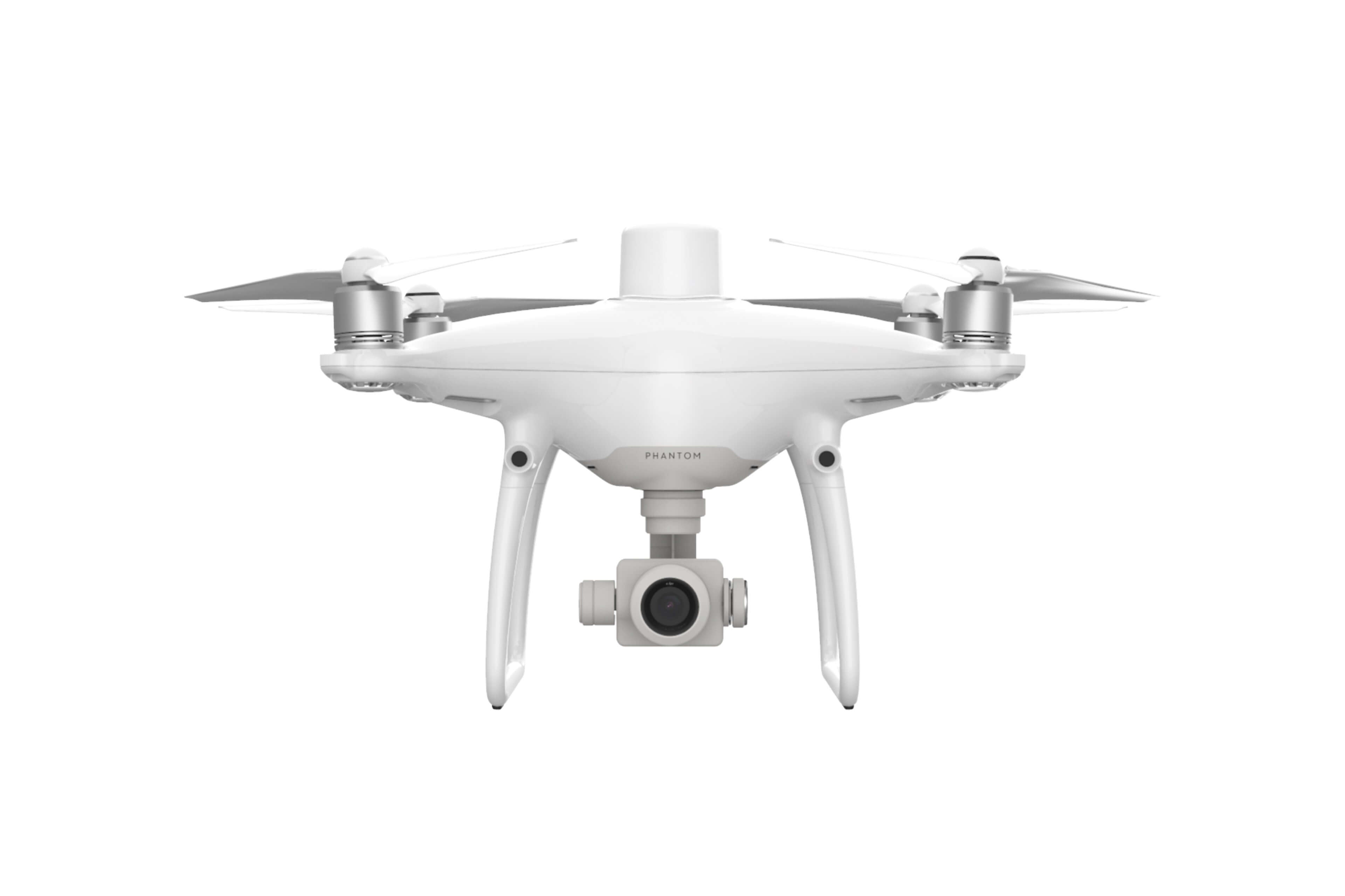
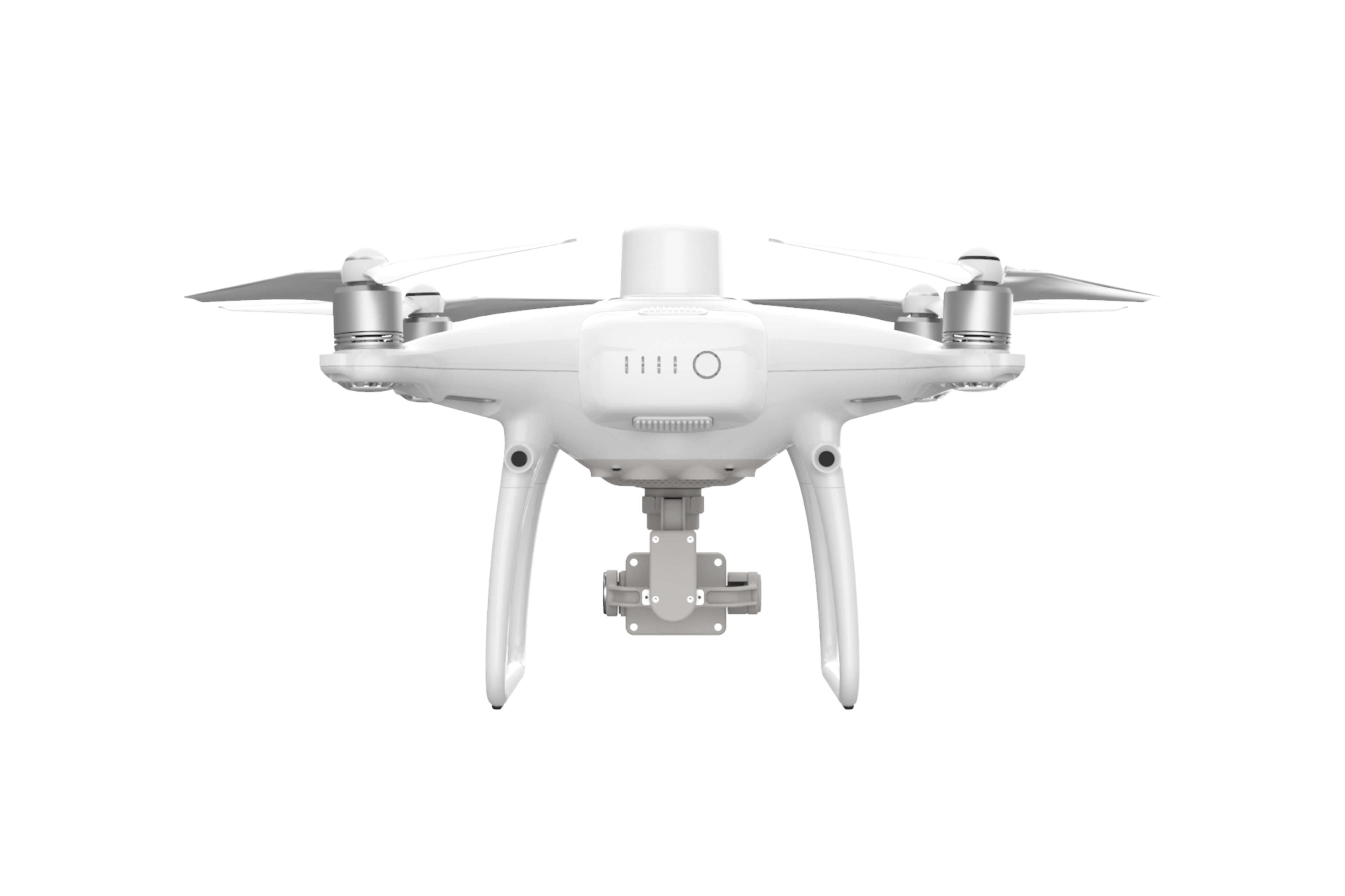
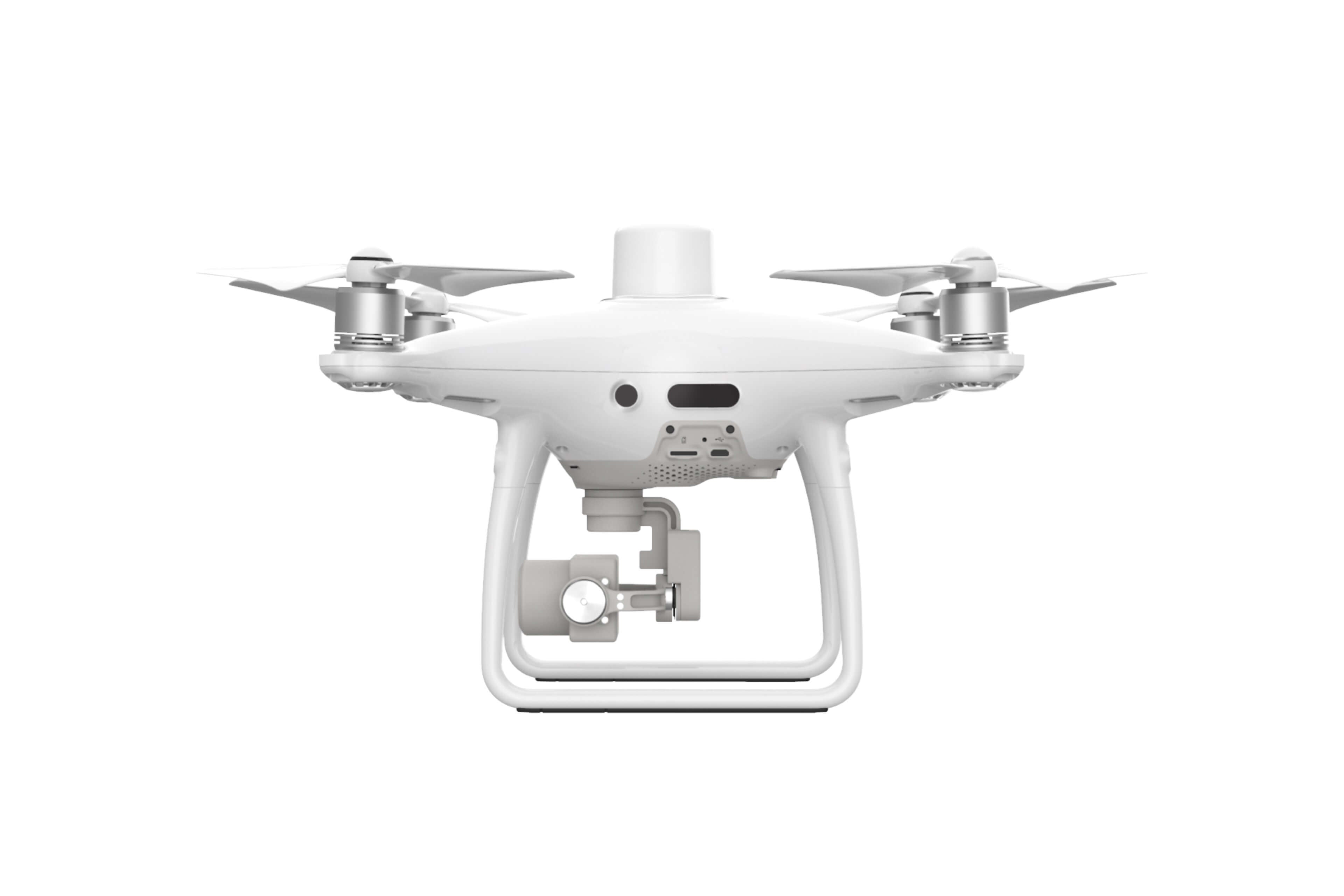
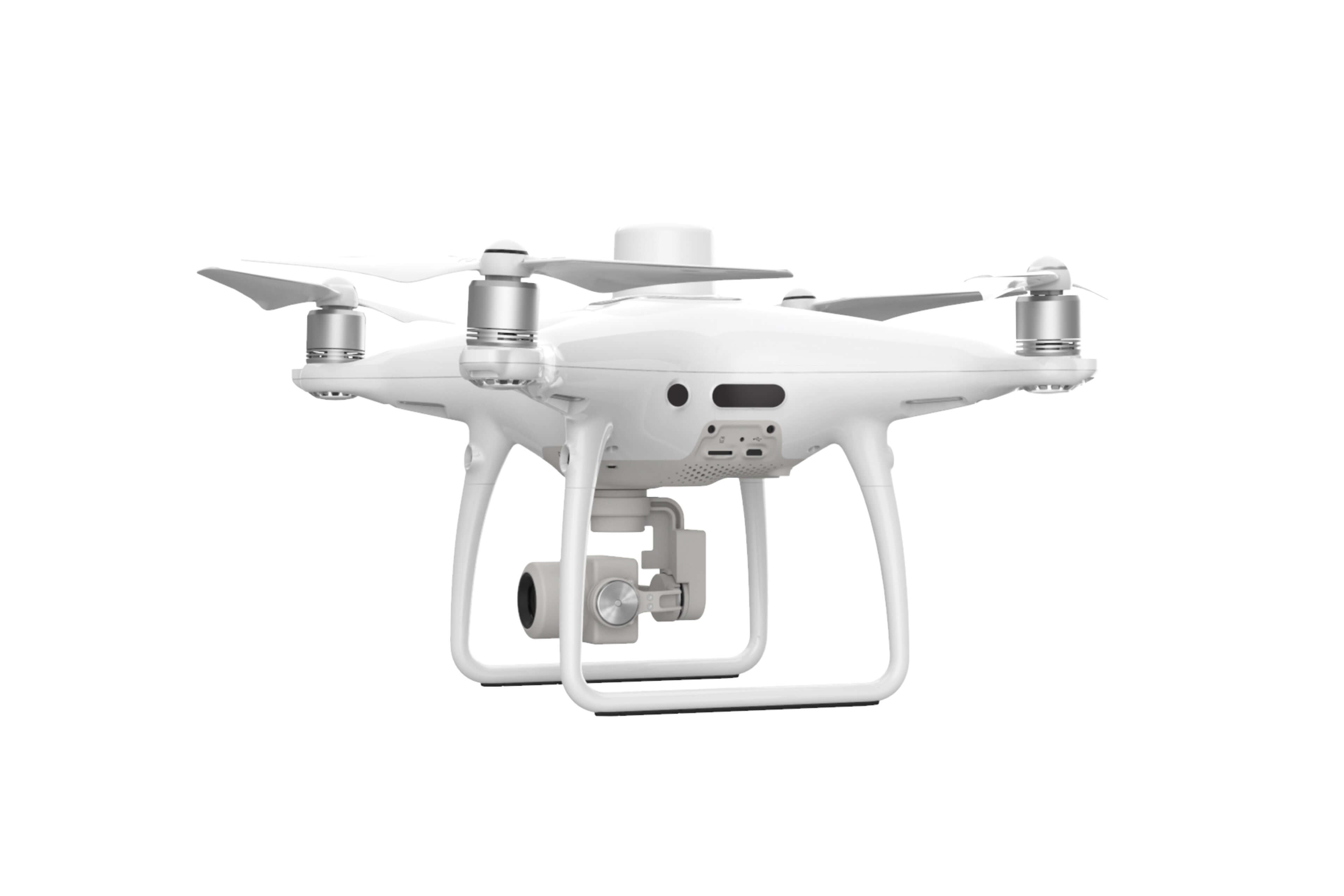
Introducing the Phantom 4 RTK. Now capable of mapping and surveying in one high-resolution camera. The Phantom 4 RTK camera allows it to capture centimeter-accurate RTK data.
Next Generation of Mapping
DJI has rethought its drone technology from the ground-up, revolutionizing it's systems to achieve a new standard of drone accuracy - offering Phantom Pro RTK centimeter - accurate date while requiring fewer grounf control points

A Centimeter Level Positioning System
Having the RTK module on the Phantom 4 RTL, the real-time centimeter-level position is vastly upgraded allowing for a more accurate image metadata. In areas that can cause interference such as dense cities and heavily forested areas, the Phantom 4 RTK can thrive as it can provide integrity to the most precise data capture for mapping, surveying and inspection work.
Fit the Phantom 4 RTK to any work flow through
- D-RTK 2 Mobile Station
- Network Transport of RTCM via Internet Protocol (NTRIP) using a 4G dongle or WiFi hotspot
- Satellite observation data to be used for Post Processed Kinematics (PPK)
Gather Accurate Data with TimeSync
To take full advantage of the Phantom 4 RTK's positioning modules, the new TimeSync system was created to continually align the camera, flight controller, RTK module and camera. TimeSync also ensures that each photo uses the most accurate metadata and fixes the positioning data to the center of the CMOS, thus optimizes the results from the photogrammetric methods- ultimately allowing the image to achieve centimeter-level positioning data.
Ultra-Precise Imaging System
The Phantom 4 RTK can now capture the best image data possible due to the Phantom 4 Pro's camera featuring a 1-inch, 20 -megapixel sensor. With a built in mechanical shutter, mapping missions and regular data capture are seamless; the Phantom 4 RTK can move while taking pictures without the risk of any rolling shutter blur- thus preserving the integrity of the photos. The high resolution of its camera, the Phantom 4 RTK can achieve a Ground Sample Distance (GSD) of 2.74 cm at 100 meters flight altitude. Phantom 4 RTK accuracy is unparalleled through its intense process. The camera lens goes through a rigorous calibration process where tangential and radial lens distortion are measured carefully. Afterwards, the distortion parameters are gathered and saved into each image's metadata, the image then goes through a post-processing software to uniquely adjust for every user.
Purpose-Built Flight Planning Application
With the new GS TRK app, intelligent control gives the pilots two different planning modes when using the Phantom 4 RTK - Photogrammetry and Waypoint Flight, in addition to a more traditional flight mode. Pilots can now select the drone's flight path while adjusting overlap rate, altitude, camera parameters, speed, and more, offering an automated mapping and/or inspection workflow with their flight planning.
The GS RTK App was designed with its “users first” mentality offers a full range of features made specifically to cater to mapping and inspection workflows. The app also has implemented direct loading of KML area files for in-office flight planning, a brand new shutter priority mode to keep exposure consistent across all photos, as well as a strong wind alarm to warn pilots of any adverse or extreme conditions.
Mobile SDK Supported
The Phantom 4 RTK is compatible with the DJI Mobile SDK, which opens up its functions to customization and automation through a mobile device. (Coming Soon)
OcuSync Transmission System
Users can enjoy extremely stable and reliable HD image and video transmission at distances of up to 7 kilometers, which is perfect for mapping larger sites.

Seamless Compatibility with D-RTK 2 Mobile Station
Operators can support your Phantom 4 RTK missions with the D-RTK 2 Mobile Station - providing users with real-time differential data to the drone and forming an accurate surveying solution. The OcuSync 2 Transmission system and the Mobile Station's rugged design ensures that operators can gain centimeter-level accurate data with their Phantom 4 RTK in any condition.

Start Mapping Today
With an easy method to collect RTK Data (RTK Network or D-RTK 2 Mobile Station) and a built-in flight planning app (GS RTK), pilots have a full solution for any surveying, inspection, or mapping workflow right out of the box.
Tech Specs
Aircraft
| Takeoff Weight | 1391 g |
|---|---|
| Diagonal Distance | 350 mm |
| Max Service Ceiling Above Sea Level | 19685 ft (6000 m) |
| Max Ascent Speed | 6 m/s (automatic flight); 5 m/s (manual control) |
| Max Descent Speed | 3 m/s |
| Max Speed | 31 mph (50 kph)(P-mode) 36 mph (58 kph)(A-mode) |
| Max Flight Time | Approx. 30 minutes |
| Operating Temperature Range | 32° to 104° F (0° to 40℃) |
| Operating Frequency | 2.400 GHz to 2.483 GHz (Europe, Japan, Korea) 5.725 GHz to 5.850 GHz (United States, China) |
| Transmission Power (EIRP) | 2.4 GHz CE (Europe) / MIC (Japan) / KCC (Korea) :< 20 dBm 5.8 GHz SRRC(China) / FCC(United States)/NCC(Taiwan,China):< 26 dBm |
| Hover Accuracy Range | RTK enabled and functioning properly: Vertical:±0.1 m;Horizontal:±0.1 m RTK disabled Vertical:±0.1 m(with vision positioning ); ±0.5 m(with GNSS positioning) Horizontal:±0.3 m(with vision positioning); ±1.5 m(with GNSS positioning) |
| Image Position Offset | The position of the camera center is relative to the phase center of the onboard D-RTK antenna under the aircraft body's axis:(36, 0, and 192 mm) already applied to the image coordinates in Exif data. The positive x, y, and z axes of the aircraft body point to the forward, rightward, and downward of the aircraft, respectively. |
Mapping Functions
| Mapping Accuracy ** | Mapping accuracy meets the requirements of the ASPRS Accuracy Standards for Digital Orthophotos Class Ⅲ ** The actual accuracy depends on surrounding lighting and patterns, aircraft altitude, mapping software used, and other factors when shooting. |
|---|---|
| Ground Sample Distance(GSD) | (H/36.5) cm/pixel, H means the aircraft altitude relative to shooting scene (unit: m) |
| Data Acquisition Efficiency | Max operating area of approx. 1 km² for a single flight(at an altitude of 182 m, i.e., GSD is approx. 5 cm/pixel, meeting the requirements of the ASPRS Accuracy Standards for Digital Orthophotos Class Ⅲ |
Vision System
| Velocity Range | ≤31 mph(50 kph) at 6.6 ft(2 m) above ground with adequate lighting |
|---|---|
| Altitude Range | 0-33 ft(0 - 10 m) |
| Operating Range | 0-33 ft(0 - 10 m) |
| Obstacle Sensing Range | 2-98 ft(0.7-30 m) |
| FOV | Forward/Rear: 60° (horizontal), ±27° (vertical) Downward: 70° (front and rear), 50° (left and right) |
| Measuring Frequency | Forward/Rear:10 Hz; Downward: 20 Hz |
| Operating Environment | Surfaces with clear patterns and adequate lighting(> 15 lux) |
Camera
| Sensor | 1" CMOS; Effective pixels: 20 M |
|---|---|
| Lens | FOV 84°;8.8 mm / 24 mm(35 mm format equivalent:24 mm); f/2.8 - f/11, auto focus at 1 m - ∞ |
| ISO Range | Video:100-3200(Auto) 100-6400(Manual); Photo:100-3200(Auto) 100-12800(Manual) |
| Mechanical Shutter Speed | 8 - 1/2000 s |
| Electronic Shutter Speed | 8 - 1/8000 s |
| Max Image Size | 4864×3648(4:3); 5472×3648(3:2) |
| Video Recording Modes | H.264,4K:3840×2160 30p |
| Photo Format | JPEG |
| Video Format | MOV |
| Supported File Systems | FAT32(≤ 32 GB); exFAT(> 32 GB) |
| Supported SD Cards | MicroSD, Max Capacity: 128 GB. Class 10 or UHS-1 rating required Write speed≥15 MB/s |
| Operating Temperature Range | 32° to 104° F (0° to 40℃) |
Intelligent Flight Battery(PH4-5870mAh-15.2V)
| Capacity | 5870 mAh |
|---|---|
| Voltage | 15.2 V |
| Battery Type | LiPo 4S |
| Energy | 89.2 Wh |
| Net Weight | 468 g |
| Charging Temperature Range | 14° to 104℉(-10° to 40℃) |
| Max charging Power | 160 W |
Intelligent Battery Charing Hub(WCH2)
| Input Voltage | 17.3 - 26.2 V |
|---|---|
| Output Voltage and Current | 8.7 V,6 A;5 V,2 A |
| Operating Temperature | 41° to 104℉(5° to 40℃) |
SDK Remote Controller
| Operating Frequency | 2.400 GHz to 2.483 GHz (Europe, Japan, Korea) 5.725 GHz to 5.850 GHz (Other countries/regions) |
|---|---|
| EIRP | 2.4 GHz CE / MIC / KCC: < 20 dBm 5.8 GHz FCC / SRRC / NCC: < 26 dBm |
| Max Transmission Distance | FCC / NCC: 4.3 mi (7 km); CE / MIC / KCC / SRRC: 3.1 mi (5 km) (Unobstructed, free of interference) |
| Built-in Battery | 6000 mAh LiPo 2S |
| Operating Current / Voltage | 1.2 A @ 7.4 V |
| Mobile Device Holder | Tablets and smartphones |
| Operating Temperature | 32° to 104° F (0° to 40° C) |
GNSS
| Single-Frequency, High-Sensitivity GNSS Module | GPS+BeiDou+Galileo(Asia); GPS+GLONASS+Galileo(other regions) |
|---|---|
| Multi-Frequency Multi-System High-Precision RTK GNSS | Frequency Used: GPS:L1/L2; GLONASS:L1/L2; BeiDou:B1/B2; Galileo:E1/E5a First-Fixed Time:< 50 s Positioning Accuracy: Vertical 1.5 cm + 1 ppm(RMS); Horizontal 1 cm + 1 ppm(RMS) 1 ppm means the error has a 1mm increase for every 1 km of movement from the aircraft. |
Gimbal
| Stabilization | 3-axis (tilt, roll, yaw) |
|---|---|
| Pitch | -90° to +30° |
| Max Controllable Angular Speed | 90°/s |
| Angular Vibration Range | ±0.02° |
Infrared
| Obstacle Sensing Range | 0.6-23 ft(0.2 - 7 m) |
|---|---|
| FOV | 70°(Horizontal) ±10°(Vertical) |
| Measuring Frequency | 10 Hz |
| Operating Environment | Surface with diffuse reflection material, and reflectivity> 8%(such as wall,trees, humans, etc.) |
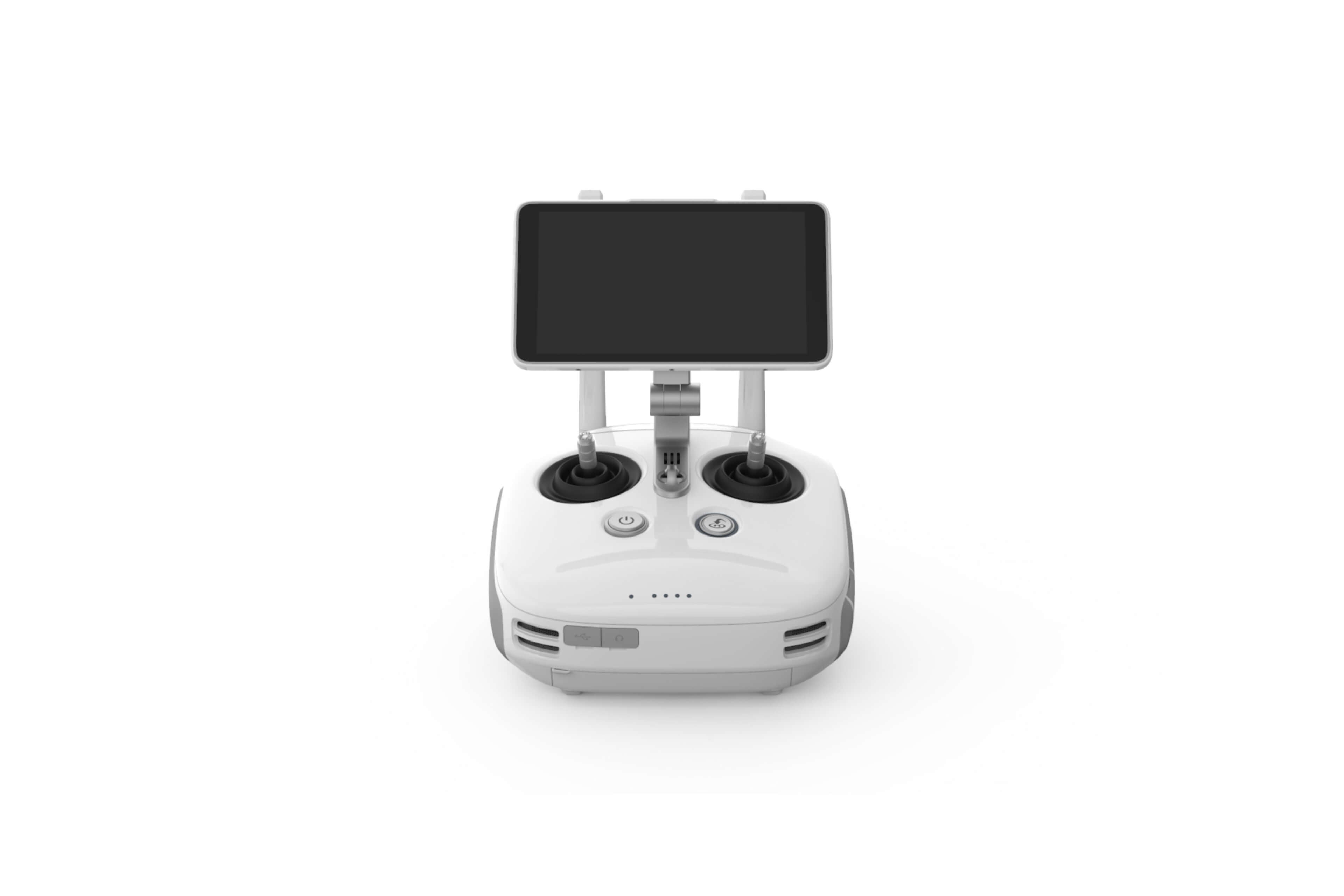
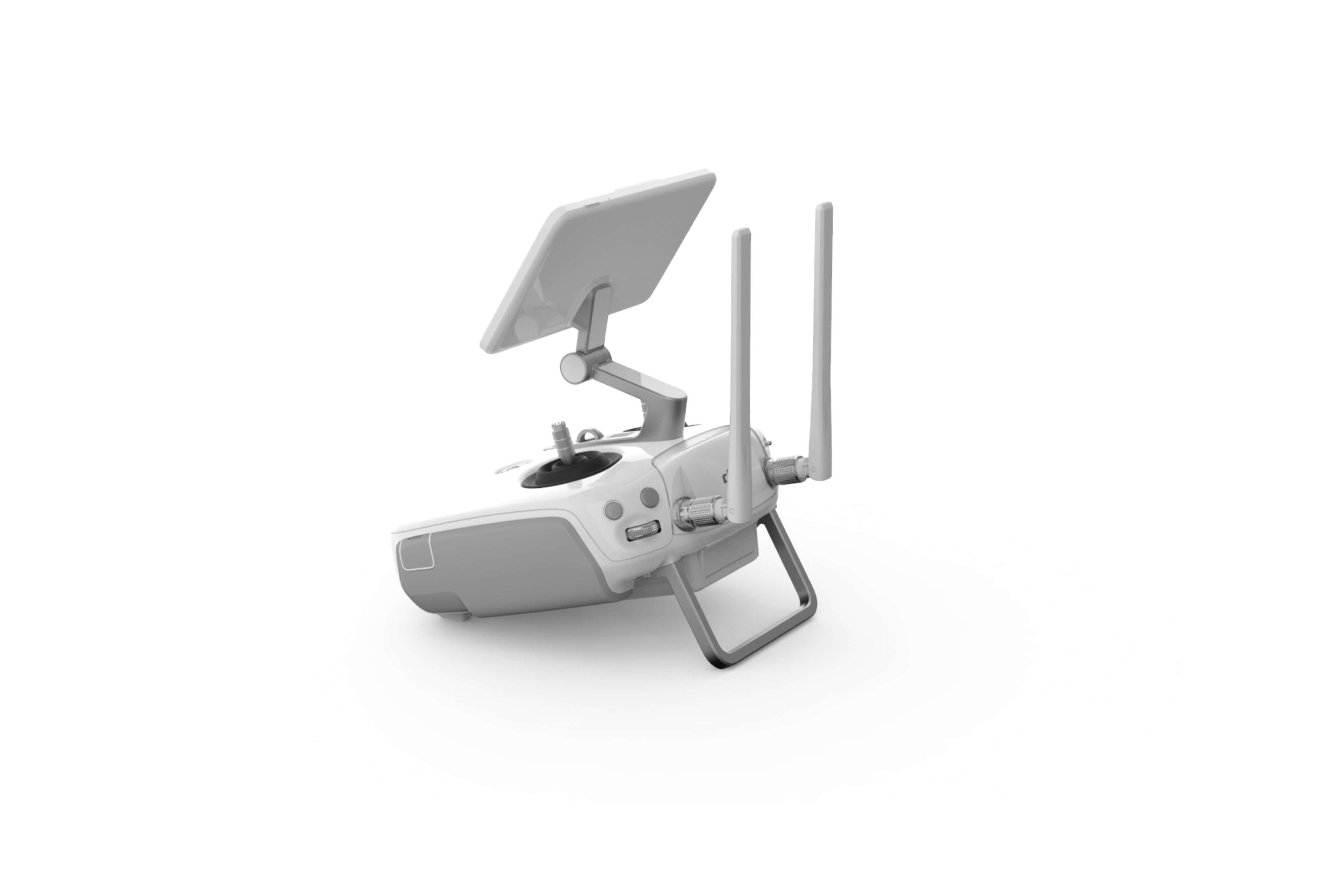
Remote Controller
| Operating Frequency | 2.400 GHz-2.483 GHz(Europe,Japan,Korea) 5.725 GHz-5.850 GHz(United States, China) |
|---|---|
| Transmission Power (EIRP) | 2.4 GHz CE / MIC / KCC:< 20 dBm 5.8 GHz SRRC / FCC:< 26 dBm |
| Max Transmission Distance | FCC:4.3 mi(7 km); SRRC / CE / MIC / KCC:3.1 mi(5 km) (Unobstrcted, free of interference) |
| Power Consumption | 16 W(typical value) |
| Display | 5.5 inch screen, 1920×1080, 1000 cd/m², Android System Memory 4G RAM+16G ROM |
| Operating Temperature Range | 32° to 104° F (0° to 40℃) |
Intelligent Flight Battery Charging Hub(PHANTOM 4 CHARING HUB)
| Voltage | 17.5 V |
|---|---|
| Operating Temperature Range | 41° to 104℉(5° to 40℃) |
| Capacity | 4920 mAh |
| Voltage | 7.6 V |
| Battery Type | LiPo 2S |
| Energy | 37.39 Wh |
| Operating Temperature | -4° to 104℉(-20° to 40℃) |
AC Power Adapter(PH4C160)
| Voltage | 17.4 V |
|---|---|
| Rated Power | 160 W |
In The Box
(In The Box)
- Phantom 4 RTK Body
- D-RTK 2 Mobile Station
- Remote Controller
- Propeller Pair x4
- Intelligent Flight Battery x2
- AC Power Cable
- Remote Controller Intelligent Battery
- AC Power Adapter
- Intelligent Battery Charging Hub
- Intelligent Flight Battery Charging Hub
- Gimbal Clamp
- MicroSD Card (16GB)
- Carrying Case
- Micro USB Cable
- USB-C Cable
- USB-C OTG Cable
- Phillips Screw x2
- Enterprise Shield
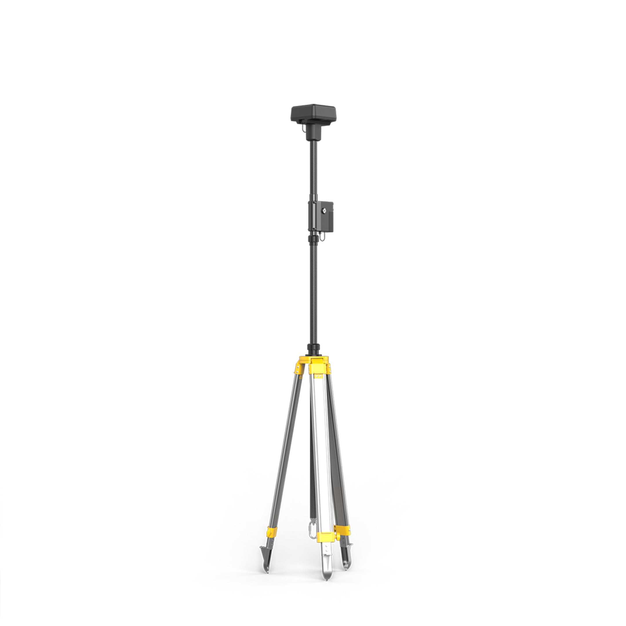
- D-RTK 2 High Precision GNSS Mobile Station
- D-RTK 2 Base Station Tripod